A number of preliminary images have been collected during Kanyini’s on-orbit commissioning phase, demonstrating the incredible depth of data the satellite will be able to provide once fully operational.
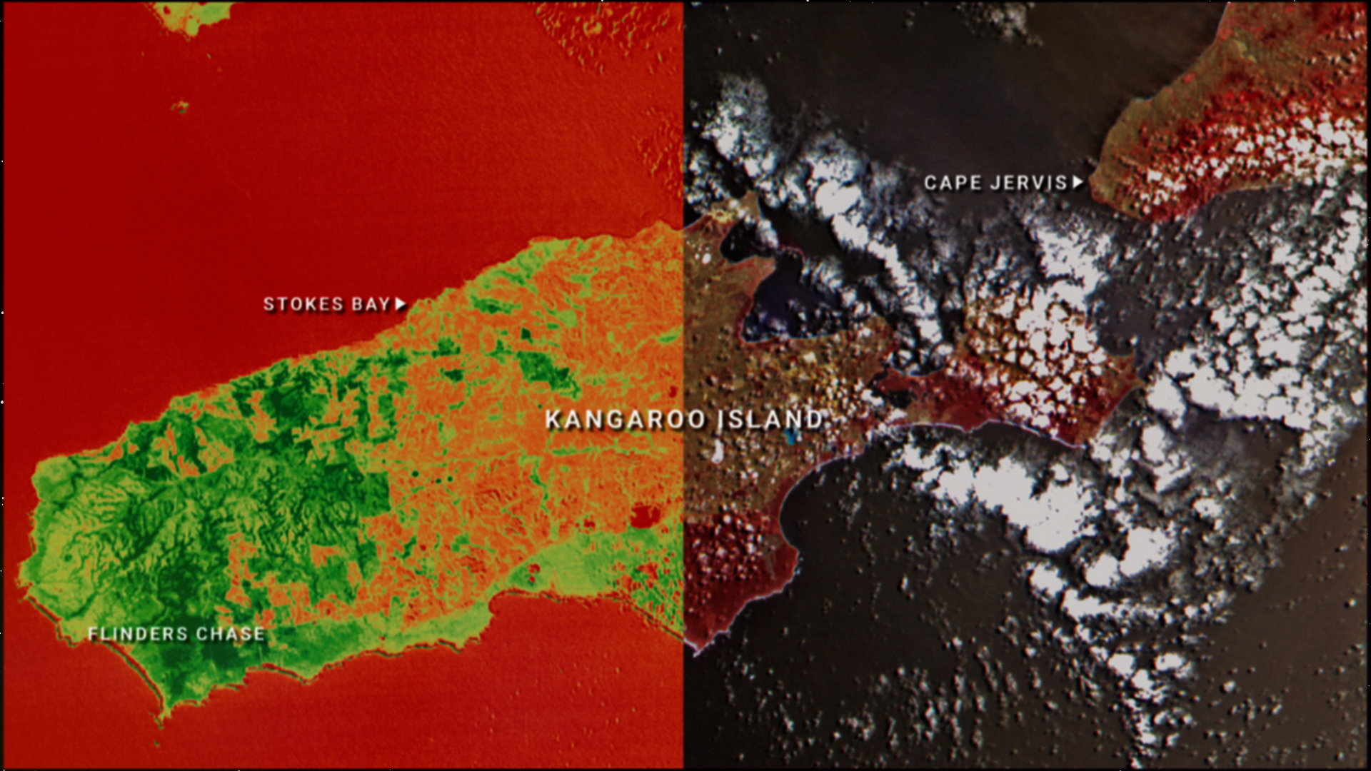
The first processed images released a couple of weeks ago, capture high resolution views of South Australian regions including Kangaroo Island, Yorke Peninsula and Adelaide. The vast amount of data behind each image allows them to be processed to reveal infrared details ordinarily invisible to the human eye, that can be used in monitoring crop health, vegetation density and changes in inland and coastal water conditions.
Since it was launched aboard Transporter 11 last August, the team has been working through commissioning of the satellite’s systems, confirming that the solar panels and batteries are functional and X-band radio communications are all operational.
The Kanyini mission is Australia’s first state-owned satellite and is a joint initiative between the South Australian Government, SmartSat CRC, Inovor Technologies and Myriota. Once fully operational, Kanyini will deliver critical space data to support future research projects by government and research institutions, particularly in the areas of sustainability and climate impacts.