

A critical water source for vast areas of the Northern Territory is drying at an accelerating rate, according to new findings, with losses clearly visible from space.
The Cambrian Limestone Aquifer is a large, interconnected limestone system containing high-quality groundwater that supports numerous NT rivers, towns, Indigenous communities, pastoral enterprises, and irrigated agriculture.
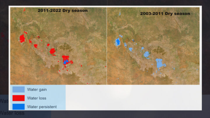
But the findings, published in a new study led by Griffith University researchers, show the aquifer has experienced significant water loss since 2014, reaching its lowest recorded storage level in 2021 – at the end of the study period.
The study draws on two decades of data (2002-2022), including ground-based bore monitoring from the Bureau of Meteorology and remote sensing from multiple satellites.
Among them, NASA’s GRACE satellite – used to track groundwater depletion globally – detects subtle changes in Earth’s gravity, indicating how much water has been lost underground.
This drying trend occurred despite fewer severe droughts during the 2011-2022 period than in the previous decade.